


Government Maps 515,000 Hectares For Rice Production To Attract Investment, Cut Imports
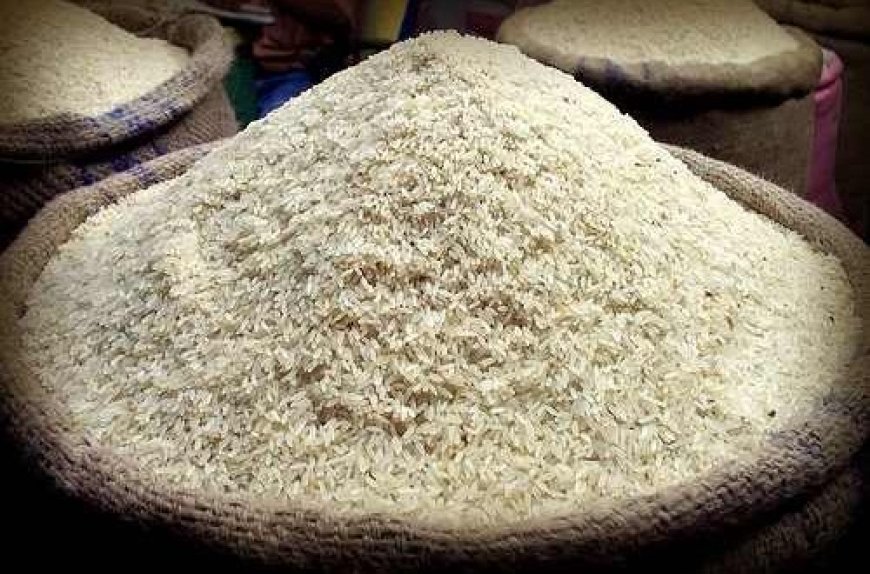
The government has identified approximately 515,000 hectares of land currently under rice cultivation through an advanced satellite-based mapping exercise aimed at attracting investment into Ghana’s rice sector and accelerating the country’s drive toward self-sufficiency.
Speaking at the West Africa Rice Investment Roundtable in Accra on June 2, 2026, the Minister of Food and Agriculture, Eric Opoku, said the initiative is to provide investors with reliable data and reduce uncertainty in agricultural investments.
According to the minister, the government has commissioned advanced geospatial mapping technology to properly characterise rice-suitable lands across the country. The exercise is also helping to organise production areas into clusters while assessing water availability and irrigation potential.
“We have commissioned advanced satellite-based geospatial mapping to identify, delineate and characterise rice-suitable land nationwide,” Mr Opoku said.
He explained that the mapping programme is designed to determine the full land area required for Ghana to achieve rice self-sufficiency while providing detailed information on field boundaries, current cultivation patterns and production potential.
“Initial findings from the exercise indicate that about 515,000 hectares of land are already under rice cultivation across the country’s rain-fed lowland, irrigated lowland and inland valley production systems," he noted.
For investors, Mr Opoku said the data offers unprecedented visibility into opportunities within the rice value chain.
“What this means for the partners and investors in this room is straightforward. We are no longer offering you vague potential. We are offering verified, location-specific, investment opportunities,” he stated.
The minister noted that the availability of precise data on land location, ecological characteristics and productivity gaps will enable investors and financial institutions to make more informed decisions while reducing the risks often associated with agricultural financing.
“Land we can point to on the map, with its ecology characterised and its productivity gap quantified,” he added.
Beyond identifying investment opportunities, Mr Opoku said the satellite infrastructure will allow authorities to monitor crop development and estimate yields on a seasonal basis, providing greater transparency and accountability across the sector.
He emphasised that the ability to track performance using reliable data would strengthen confidence among investors and lenders seeking to finance rice production and processing projects.
“Because the same satellite backbone allows us to monitor crop development and estimate yields season by season, it gives investors and financiers something they rarely have in smallholder agriculture — transparency and a credible basis for tracking performance,” he said.
Mr Opoku described the initiative as a critical step toward making Ghana’s national rice expansion programme more attractive to private capital, stressing that investment-backed growth remains central to the government’s strategy to reduce rice imports and strengthen domestic food production.
“This is how we make a national rice expansion programme bankable,” he concluded.
Click the link Puretvonline.com | WhatsApp Channel to join the WhatsApp channel
GOT A STORY?
Contact/WhatsApp: +233243201960 or manuelnkansah33@gmail.com